
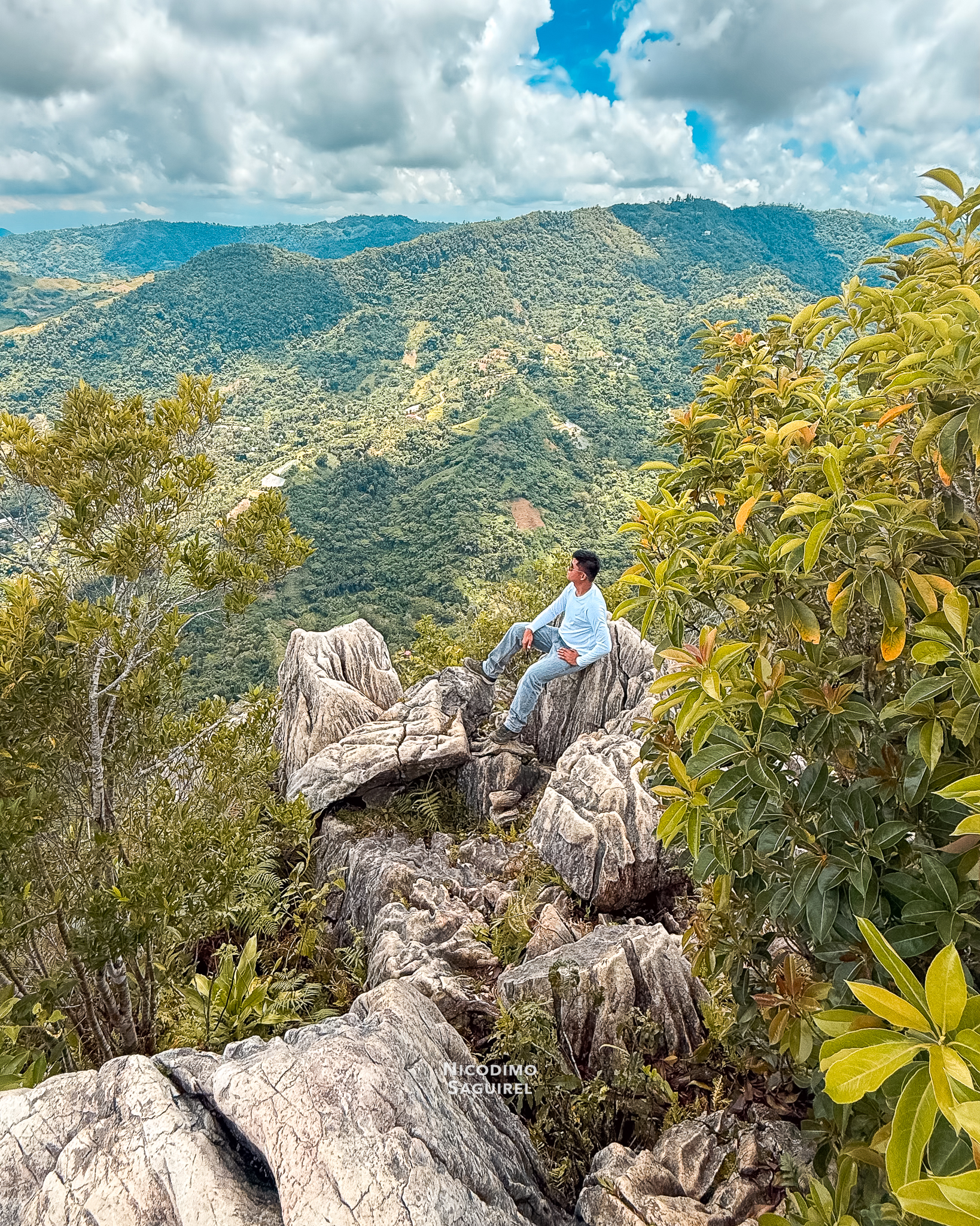


The Mt. Manunggal Peak in the municipality of Balamban, Cebu, is the third highest peak in the island of Cebu after Osmeña Peak and Lugsangan Peak.
Mt. Manunggal Description
The peak of Mt. Manunggal is composed of distinct rock formation that is similar to an eroded and cracked single huge boulder with elongated parts. Upon ascending to the summit, you will notice right away the cracking-like structure of rocks along the way. When you reach the top, the surrounding view and the summit itself feels a rewarding experience to yourself.
From the summit, visitors can enjoy panoramic views of the surrounding mountains, forests, and nearby communities. The cool mountain breeze and peaceful atmosphere make the peak an ideal place to rest and appreciate the natural landscape. The unusual rock formations provide excellent opportunities for photography and geological observation.
Hikers are encouraged to stay on designated trails and practice responsible outdoor ethics to help preserve the mountain’s natural environment. The combination of unique rock formations, scenic vistas, and a challenging ascent makes Mt. Manunggal a memorable destination for nature lovers and adventure seekers.
Mt. Manunggal Accessibility
I think this mountain is a mild beginner-friendly to trek. During rainy season, some portions of the path might be muddy and slippery in your jump-off hike. I remember my tour guide accidentally slipped because the path is wet, slippery and he was only wearing slider slippers. Along the way, you will pass by the monuments of crashed airplane engine part and the monument of President Ramon Magsaysay. The hike may take around 40 minutes to 1 hour (one-way). The rocky ascent going to the summit may take around 15 minutes.
Mt. Manunggal History
The Mt. Manunggal is widely known because the presidential plane Mt. Pinatubo crashed in the area and killed President Ramon Magsaysay and 24 others on March 17, 1957.
How To Get There?
Go to Mt. Manunggal Eco-Adventure (Baguio de Cebu Eco-Adventure) in Balamban, Cebu, via Cebu Transcentral Highway or popularly known as TCH. You can also use map apps on your phone to pin the said location. They also have an in-house tour guide there.
Mt. Manunggal Details
📌 LOCATION: Mount Manunggal – Barangay Sunog, Balamban, Cebu, Philippines
[₱] ENTRANCE FEE (Mt. Manunggal Eco-Adventure, or Baguio de Cebu Eco-Adventure):
▪️ VIEWING: ₱50.00/head
▪️ OVERNIGHT/CAMPING: ₱100.00/head
▪️ SKYBIKE: ₱200.00/head
▪️ TREKKING: ₱450.00 (1-5 person, 1 tour guide)
▪️ HORSE BACKRIDING: ₱150.00/head (10-15 minutes)
🅿️ PARKING FEE: FREE
🛣 TRAILHEAD ACCESSIBILITY:
🚘 By CAR
🏍 By MOTORCYCLE
⚠️ All prices, rates and others that are mentioned above may change without prior notice.


